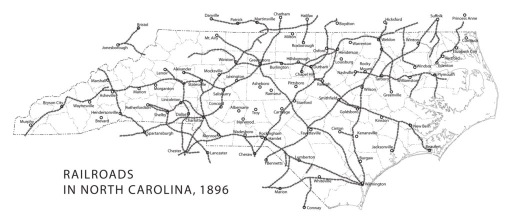
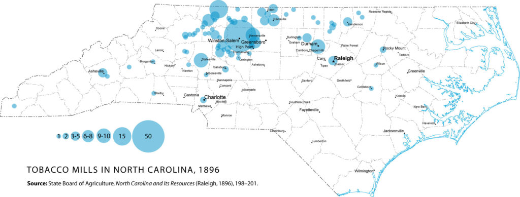
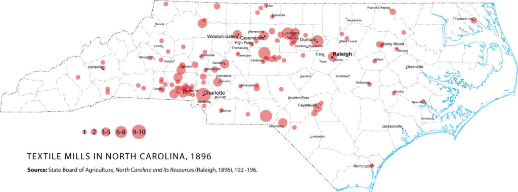
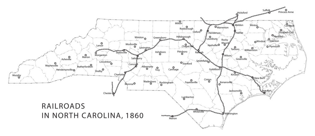
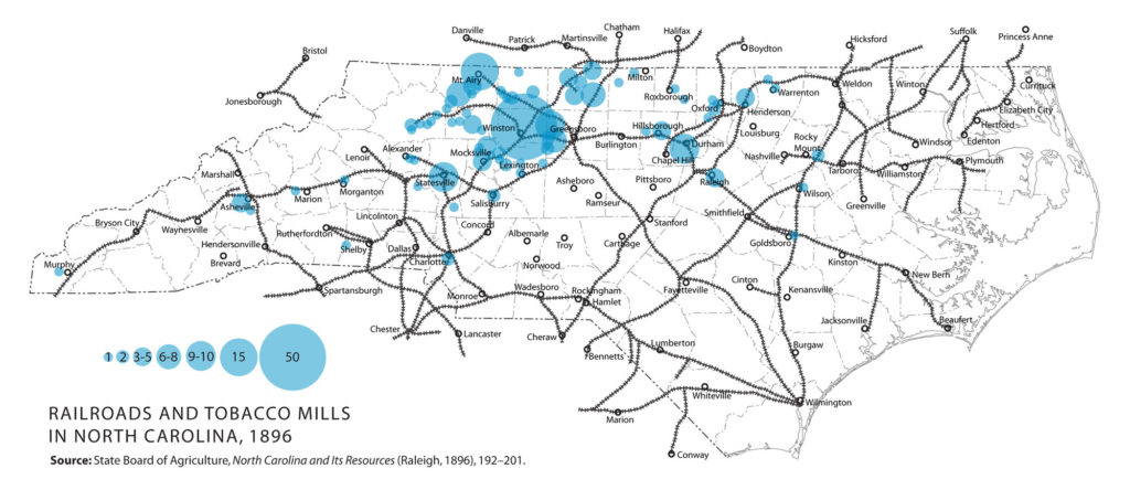
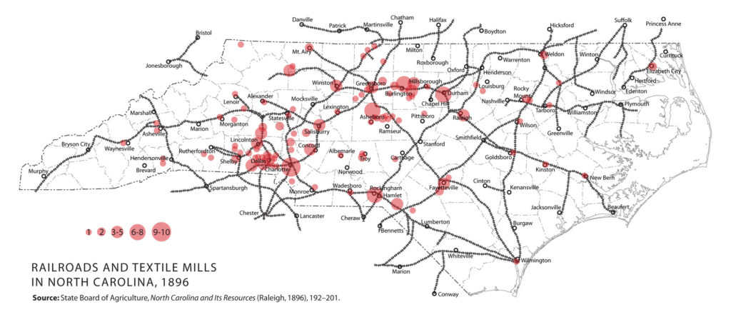
I created these maps for LEARN NC as part of a unit on industrialization in North Carolina to show why factories were built where they were. The map showing the location of textile mills was used in an exhibit at the North Carolina Museum of History in 2011.
The counties in each map are drawn with present-day boundaries for reference. Click any map for a larger version.
Factories
Railroads
Factories and railroads
Maps on this page were originally published by LEARN NC and are licensed under a Creative Commons license (CC-BY-ND).
