I created these maps for LEARN NC as part of a unit on industrialization in North Carolina to show why factories were built where they were. The map showing the location of textile mills was used in an exhibit at the North Carolina Museum of History in 2011.
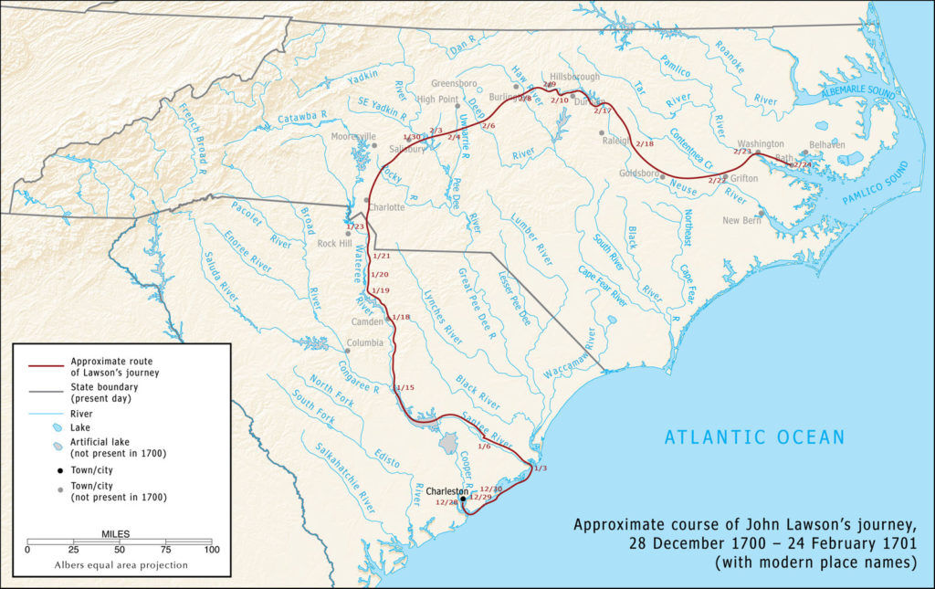
John Lawson’s explorations, 1700–1701
I created this map for LEARN NC in 2009 to show the approximate route of John Lawson, who explored the Carolinas in 1700–1701 and documented his travels in A New Voyage to Carolina (1709). I had intended the map to accompany a web-based critical edition of Lawson’s book, but I wasn’t able to finish the project.
I drew a new version of this map for The Curious Mister Catesby: A “Truly Ingenious” Naturalist Explores New Worlds, published by the University of Georgia Press in 2015.
